Drone Assist, a popular drone flight planning and approval app in the UK, has received a new update to give users a greater understanding of airspace restrictions and NOTAMs (Notice to Aviators).
According to Unified Traffic Management (UTM) technology provider Altitude Angel — the brain behind Drone Assist — the new features have been made possible through an update to the company’s own airspace data processing.
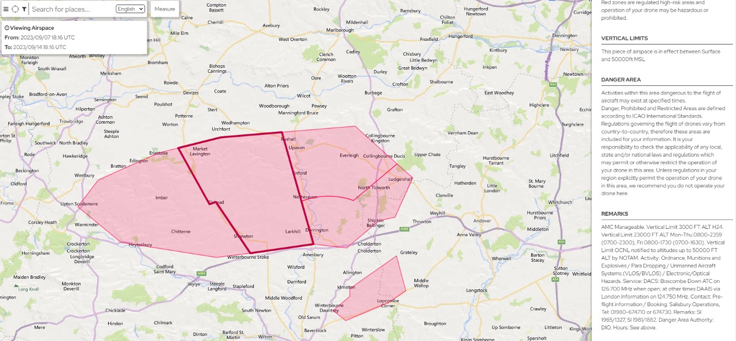
Essentially, the app now publishes remarks for all “Danger, Prohibited, and Restricted Areas” based on details supplied by relevant authorities. You can now expect more detailed information about the timing, nature of the hazard, type of restriction, and authority contact details.
Also read: Wing seeks FAA nod for 10,000 drone delivery flights in Dallas per day
The second update, meanwhile, addresses some additional NOTAM categories. Altitude Angel says it continuously reviews the type of NOTAMs it publishes through its platform, assessing their relevance to drone operations and disregarding irrelevant ones, such as ATM infrastructure (e.g., radar systems) and aerodrome services (e.g., firefighting).
The latest update to the map data means some additional NOTAMs will now be available to see on the Drone Assist app and dronesafetymap.com, as well as to cloud customers using Altitude Angel’s airspace data service. The new categories are:
- GNSS area-wide operations (relating to jamming trials)
- Obstacles (relating to cranes or rigs)
- Captive balloons and kites
Simon Wynn-Mackenzie, VP of product at Altitude Angel, says, “We’ve acted on feedback we have received from operators who have told us they would like a greater understanding of restricted areas and different NOTAM categories which can pose a ‘risk’ when flying. We hope our users enjoy the additional data we’ve now made available.”
Read more: DJI Mini 3 gets price cut ahead of Mini 4 Pro announcement
FTC: We use income earning auto affiliate links. More.


Comments