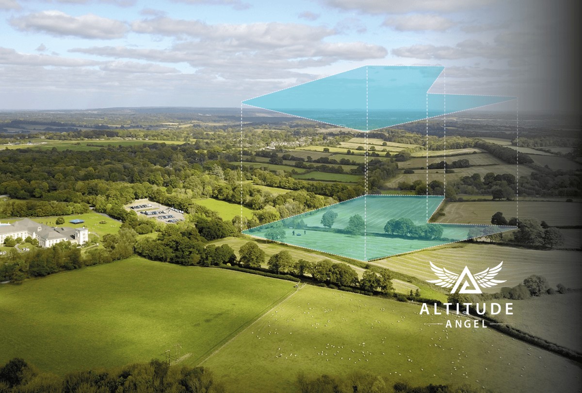
UK-based Unified Traffic Management (UTM) technology provider Altitude Angel is expanding the scope of its recently launched drone flight Approval Services platform to include property and large land estates.
The platform, which can be used by professional and recreational users alike, gives drone pilots the ability to request access to fly in restricted airspace such as an airport flight restriction zone (FRZ). But now, Altitude Angel’s Approval Services platform will also allow landowners and real estate managers to give permission to drone operators who wish to use their property for take-off and landing purposes.
Drone operators know it’s not easy to gain access to private land. Once you identify an area that is most advantageous for you to conduct your flight, you need to find out who manages the land and seek their approval. It’s a process that can take many hours, days, or even weeks!
But now, with Altitude Angel’s expanded platform, drone operators will be able to request access to the desired land digitally via the Drone Assist app or via DroneSafetyMap.com. In some instances, flight approvals will be near-instant, but the only caveat is that the landowner or manager in question should have signed up for the platform first.
Also read: New drone floodlight can illuminate two tennis courts at once
Nevertheless, it’s an exciting development. As Chris Forster, chief operating officer at Altitude Angel, points out, “By giving landowners, estate managers, and those responsible for large areas of real estate the tools to approve drone operations from the land they manage, we’re opening new places to fly and widening commercial opportunities.
“Drone operators will be able to request permission at the touch of a button and receive a response or instruction with regards to their flight in a matter of seconds, removing the time-consuming and costly process of seeking out a landowner or manager. The platform will reduce their administration burden, giving operators more time to do the best part of the job, flying.”
Read more: Autel has added 10 new features to EVO Max drone series
FTC: We use income earning auto affiliate links. More.


Comments