Drone Assist, a popular flight planning tool in the United Kingdom, has received its most extensive update since the app was first launched in 2016. The new version begins rolling out today for both iOS and Android devices.
Developed by Unified Traffic Management (UTM) specialists Altitude Angel, Drone Assist is used by professional and recreational pilots alike. And now, the app is set to introduce a host of new features which will give users an even greater understanding of the sky above them.
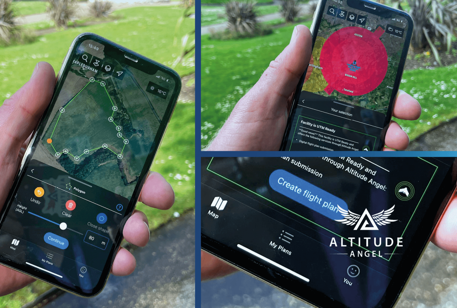
Improvements are coming to integrated flight planning and flight plan drawing tools, as well as to approval services that give pilots the ability to request access to fly digitally in airspace such as an airport FRZ, or land with access restrictions.
More specifically, Drone Assist now allows users to plan their flight, detailing exactly where they will be flying using the advanced drawing tools using polygons or waypoints, and submit the plan to the app. The flight is then displayed not only on the app for all to see but across all of Altitude Angel’s UTM platforms, including those used by airports and general aviation pilots, making other airspace users aware of their presence.
Read: DJI Mavic 2 Pro drone discovers 7,000-year-old cave art in Spain
Drone Assist is also introducing new “pilot profiles” and aircraft management, enabling users to log drone operator profiles, hours flown, and airframe hours used. These features can be particularly useful for professional drone operators who may be required to manage or evidence their operational experience.
Other app upgrades include:
- New map layers including satellite view
- Enhanced airspace filter controls
- Refreshed user experience and user interface
With the UK eyeing a $54 billion drone economy by 2020, Altitude Angel sees Drone Assist as the foundation stone for enabling “one-tap flight authorizations” at connected airports and facilities worldwide. This is why, over the coming months, Drone Assist will replace all the company’s other existing apps too.
As Richard Parker, CEO and founder of Altitude Angel, explains:
All commercial drone operations start with a plan, and planning should start with Drone Assist, which is why we’ve invested so much in creating an app that can truly enable safe drone flight anywhere. We now have a platform on which drone operators can begin to build businesses and realise the potential of drones, building an industry to change the world. And this is just the first in a series of new-feature releases we’ll be making as we continue to bring new services and opportunities to airspace users, managers, and landowners across the country and beyond.
Read: DJI RC Plus remote now compatible with M300 drone
FTC: We use income earning auto affiliate links. More.


Comments