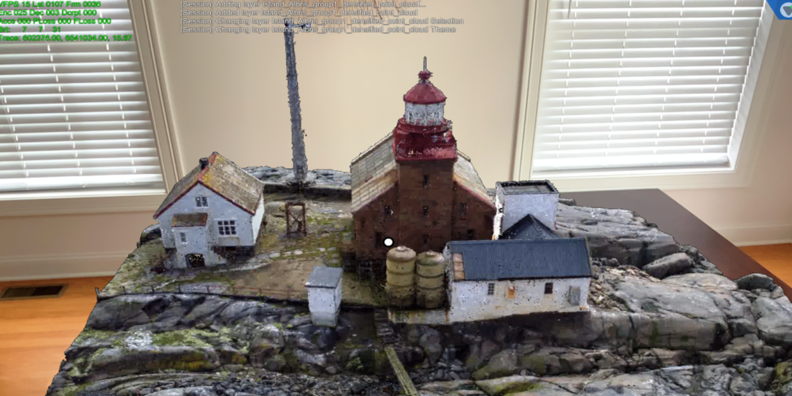
Ever wondered how your drone-mapped 3D models or point clouds would look like in an augmented reality (AR) environment? Well, there’s a way to find out.
Typically, the datasets produced by aerial photogrammetry or LiDAR are quite large and difficult to visualize on AR headsets, iPad or Android tablets, and iPhone and Android mobile devices. But Arvizio, a provider of 3D visualization and AR/VR software for real-time collaboration across geographies, has now announced compatibility for drone data in its Immerse 3D solution.
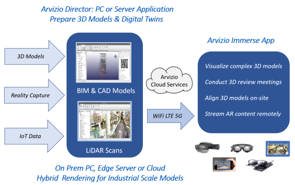
Immerse 3D is a multi-user, multi-site, 3D model visualization platform that is optimized for complex BIM, CAD, LiDAR, and photogrammetry models. To stream industrial-scale data over the wide area network (WAN), it leverages the GPU power of the user’s PC, server, or cloud-based virtual machine.
So, without requiring the development of any custom application software, multiple users can collaborate and work with the content using simple, easily accessible web meeting platforms such as Microsoft Teams and Zoom.
In addition to complex LiDAR scans, 3D aerial photogrammetry, and point clouds, Immerse 3D also allows for documents, images, and other project data to be included in AR digital twins. The following image should help you understand better:
Users of drone data AR visualizations
Nowadays, many enterprises and public work organizations are utilizing drone 3D mapping for project planning, progress tracking, and monitoring change. As such, the solution could find takers in several industries, such as construction, precision farming, infrastructure, mining, utilities, and energy.
Regular readers of DroneDJ may also recall our recent report on how drone manufacturer Parrot has struck a deal with a situational awareness technology expert, Rapid Imaging, to equip its drone videos with geospatial AR capabilities.
Pointing to how drones are enabling reliable, high-resolution 3D reality capture of vast areas and inaccessible locations, Jonathan Reeves, CEO at Arvizio, says:
We are providing our customers the ability to use their drone captures as a digital twin in synchronized AR visualization sessions for impactful, accurate project planning, monitoring and reviews. Immerse 3D offers patented level of detail processing, unique model optimization and efficient WAN transport capabilities to provide data compression and parallel streaming of large data sets to multiple AR clients.
Looking forward, the company is hopeful that the ongoing expansion of 5G networks will further enhance its low latency streaming capabilities.
FTC: We use income earning auto affiliate links. More.


Comments