The popular B4UFLY airspace awareness tool – used as a mobile app by many US drone operators – is now available via desktop/laptop.
It’s always worth checking out the airspace before a planned flight. And BFUFLY has been a staple for many drone pilots in the US. The app, produced by KittyHawk, is an excellent tool and recommended by the Federal Aviation Administration. Now, drone operators have another option: You can access this now as a web-based application.
That means by the end of this article, you can do a little airspace check for your neck of the woods.
Use BFUFLY Before You Fly
Pre-flight planning is, in some ways, just as important as your mission itself. You should know the airspace you’re going to fly in, whether there are any advisories in effect (such as the drone ban that was in effect in Tampa for the Super Bowl), as well as any local anomalies that other users in your area might have reported.
You could do this before, using mobile. Now, you can explore the same functionality with your desktop. This is useful for mission pre-planning when you’d like to see the “big picture.”
How does it work?
It’s simple. Type in the address and the information will pop up. What airspace is this? Are there any restrictions in effect? Has anyone uploaded a local advisory?
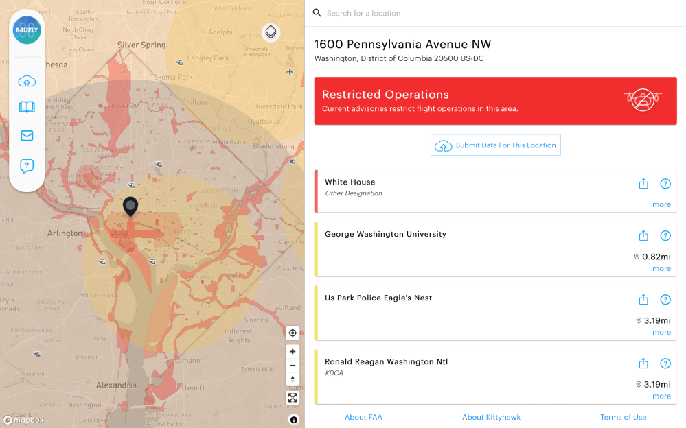
We decided to try an example where we knew there would be restrictions. So we typed in 1600 Pennsylvania Avenue NW, District of Columbia. Yes, that’s the White House. And we received exactly the information we’d anticipated:
Do try this at home
If you’re at home (or the office) and can spare a couple of seconds, why not try the interface and see for yourself?
Simply click on https://b4ufly.kittyhawk.io/. Then, at the top of the screen, type in your address. You can manually move the pin if you’d like.
Got it? Now bookmark it.
Add your own advisory
One of the great things about B4UFLY is the ability to add your own advisory to a specific location. Let’s say, for example, that smoke from wildfires is impairing visibility. As the KittyHawk website explains, adding such information is a snap:
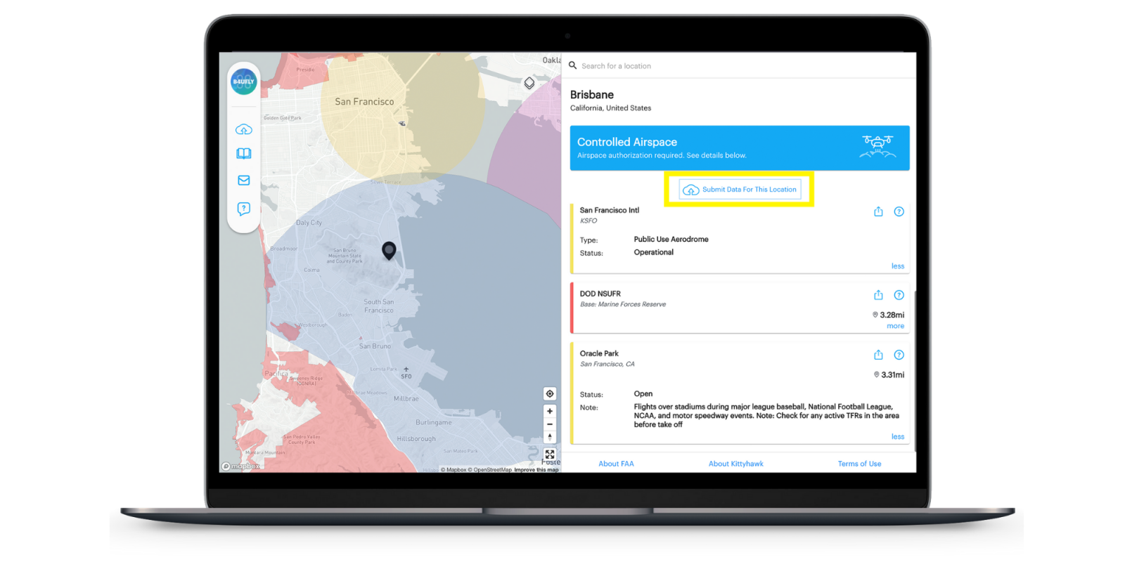
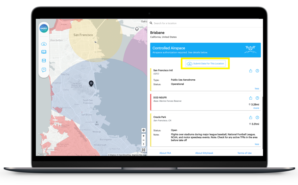
Easily submit missing data for a location or flag an existing airspace advisory for review on the web just like you can on B4UFLY mobile. To submit new data for a location that you believe is missing an airspace advisory, first make sure the pin on the map is at the desired location you wish to submit. Then click the ‘Submit Data for This Location’ button at the top (highlighted in yellow in the graphic). You will automatically be led to the data submission form and the coordinates for this location will auto-populate. Fill out the rest of the required information and submit the form.
KittyHawk.io
Here’s the image they’re referencing:
Did you try it?
If you didn’t, we recommend hopping back to that link and giving it a shot. And if you don’t already have this app downloaded to your mobile device, we highly recommended doing so.
And, next time you’re heading out with your drone, check B4UFLY.
FTC: We use income earning auto affiliate links. More.


Comments